Stories & Videos
Working together locally for farms, streams and economic growth


You can have both healthy streams and economic growth.
It takes local leaders with diverse expertise working together, with understanding of local conditions and markets: farmers, crop consultants, agriculture retailers, bankers, fishermen, biologists, mapping professionals and soil scientists. Striking a balance that benefits all is a delicate one that means building working relationships between partners. In upper Midwest communities now, farming landowners and their agricultural support networks are stepping up to change practices on the land, and invite others to consider the options.
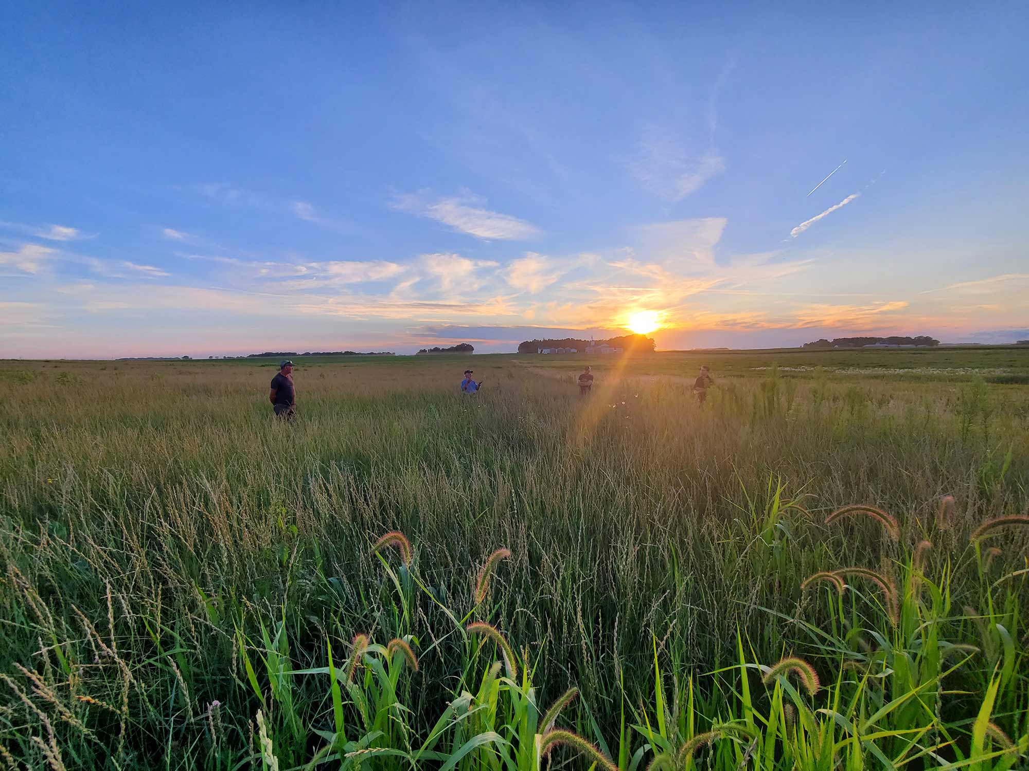
In southwest Wisconsin’s Kickapoo River area, Tom Lukens and family plan to convert vulnerable, marginally productive agricultural acres to reduce input costs, reduce soil erosion and protect water quality. Tom also has an interest in talking with others about the benefits of strategically placed native grass strips, and hopes to spark conversation locally by installing signs that explain the practice where his fields meet well-traveled roads.
Shelly Brenneman, director of Valley Stewardship Network, has worked with the Lukens family and others to develop plans, find partners, and seek cost share funding. “Demonstrations like this can help us learn how to make the most of productive land, while protecting soil and streams. Both native grass strips and cover crops keep soil and nutrients in the field, and richer soil and lower input costs can increase net farm income.”

Those practices and others can be used to advantage almost anywhere, but in southwest Wisconsin, where slopes are steep, they are vital. Land management here is tied closely to the general health of local economies, and successful collaborations have played a strong role in building stability over time.
Collaboration produces benefits on and off the farm in southwest Wisconsin
When there has been good habitat, little erosion, and a healthy ecosystem, vibrant industries have flourished in the watershed where Lukens and Brenneman live, particularly farming and angling. In this hilly region that spills from Wisconsin into corners of Iowa, Minnesota, and Illinois, fishing generates more than $1 billion annually for the local economy. In southwest Wisconsin alone, more than 11,000 miles of meandering Class 1 and 2 streams have good water quality and provide habitat to sustain populations of wild trout.

Concurrently, small to medium-sized family farms have been strengthened in recent decades by alliances with local dairy co-ops such as Westby Creamery and Organic Valley, as well as artisan cheese makers. A growing market for grassfed beef is adding value to livestock while reducing tillage and input expenses for farmers.
Overall, when diversified farms with livestock thrive, hay and grain crop rotations and learned conservation measures that protect slopes and ridge tops have continued. These diversified farmers maintain contour strips in fields, and stand ready to advise newcomers on how to manage around vulnerable sinkholes, avoid nutrient runoff into bedrock aquifers, or use effective methods like terraces, cover crops, and managed grazing to keep soil in place.
Building on a legacy of collaboration and restoration
Working together for local solutions is an old story just 10 miles west of the Kickapoo River Valley, in the Coon Creek Watershed. In the 1800s, when the region’s native prairie and oak savannah landscape was altered by farming practices brought from Europe, exposed soil on steep slopes and uplands eroded severely. Tons of topsoil moved from fields to valleys, impacting streams, fish habitat and farmers’ ability to retain a vital resource and support themselves.
After the Dustbowl, in the 1930s, many landowners sought a better solution. Faced with both a threat and an opportunity, they stepped away from old farming methods to work alongside Aldo Leopold and soil scientists to find new ways to farm ridges and slopes. Terraces and contour strips constructed then helped turn the farm economy around, and their use spread beyond Coon Valley to the rest of this hilly region. Many of those structures are still assets for successful farming today, with some protected forever for agriculture by conservation easements.

In the late 1900s—when federal financial incentives supported planting more cash crops like corn— some practices on slopes that kept soil in place were discontinued. Vernon County lost an estimated 50% of its conventional family dairy farms between 1980 and 2005. At the same time the demand for hay and oats to feed dairy livestock decreased, as did the use of contour strips. A noticeable decrease was also seen in stream quality and fish populations.
New challenges
Today, collaboration and innovation are still needed to sustain farming and its supporting industries, a diverse landscape, recreation, and strong local communities.
New farm and agricultural landowners, absentee landowners, conventional and organic producers, and residents who have lived long in the area and learned lessons of the past now hold the future, together. Established farming practices offer insight and common ground from which to build: three- to five-year rotation systems, terraces and contour strips where non-erosive crops alternate with cash crops, cover cropping, and managed grazing. All have helped protect soil and farm incomes.
More frequent flood events are increasing soil erosion and damage, requiring new solutions. Many years of tillage have compacted some soils and made them clay-like, moving water, nutrients, and topsoil quickly off fields to streams. Other soils are porous and underlain by crevices, cracks and sinkholes in limestone bedrock that allow runoff to get into aquifers below. Solutions are tricky and require planning and a variety of skills.
Streams and fish also need protection. Jeff Hastings, who leads Trout Unlimited’s Driftless Area Restoration Effort (DARE), hopes the work that’s been done to restore streams in southwest Wisconsin will continue to be positive for landowners, wildlife, and people who love the outdoors. For many years Hastings has facilitated collaborative stream restoration projects involving landowners, local contractors, and members of Trout Unlimited. He also organizes the Driftless Area Symposium annually, to bring collaborators together for friendship, learning, and action.
Management strategies: cover crops, contour strips and native grass strips
All can keep vital soil resources in tilled fields where terrain is hilly.
Cover crops minimize the amount of time tilled soil is exposed and vulnerable. They increase organic and nutrient content in soil, and thus can help produce better crop yields.
Contour strips were designed to alternate with another crop, like corn, in a fixed width along the contours of a hill. The alternated strip usually has plants with deeper roots, like oats or alfalfa (for livestock feed), and water retention capacity to soak up and reduce runoff.
Native grass strips originated as an experiment at Iowa State University, and are appearing as a viable option for tilled fields in upper Midwest states. The Iowa State model, called STRIPS (Science-based Trials of Rowcrops Integrated with Prairie Strips), customizes strips to the land with a goal of treating all runoff leaving the field. Strip widths vary depending on quantity of water to be intercepted. They are wider where more water is flowing down-slope, and narrower where less water is flowing. They are placed where filtering and absorption capacities are greatest—on slopes, at the foot of slopes, and near streams.
Prairie STRIPS function much like contour strips, with the added benefits of vital habitat for native pollinators like the decreasing population of honeybees and grassland birds like the eastern meadowlark and bobolink. Streams and fish benefit, too, when runoff is more effectively captured.

Soil health for strong rural communities
According to Iowa State University, if a watershed primarily consisting of row crops plants just 10% of land in native prairie strategically located on contours and foot slopes, sediment transport is reduced by 95%.
Why is this important, particularly here and now?
First, runoff matters in a landscape with sinkholes and fractured bedrock, which allow nitrate and surface liquids to run quickly into aquifers where drinking water exists. In southwest Wisconsin this condition exists nearly everywhere. In other states bordering the Mississippi River cracked bedrock exists too, particularly in river bluff areas.
Second, growers need to hold onto nutrients and topsoil. The deep roots of mixed native forbs and grasses increase soil organic matter and improve water infiltration, and their sturdy stems slow down surface runoff to hold soil in place during rain events. According to Iowa State, prairie strips reduce overland flow by 60% and transport of nitrogen and phosphorus by 90%.

Key take-aways
Each community has its own special conditions and landscape considerations. Universal tools exist, but there is no one-size-fits-all answer. Recommended practices to protect soil, water, and communities must be sensitive to each particular landscape. And, if widespread adoption of practices is a goal, farmer-led conversations are important.
Jeff Pape, a farmer leader in the Hewitt Creek Watershed near Dyersville, Iowa, shared stories at the gathering about his community’s successful work to reduce nutrient runoff and protect soil—their most important resource. When talking with neighboring farmers, he asks: “What amount of soil loss is tolerable?” From there erosion prevention strategies can be found, often in conversation with others who know the local landscape.
For Dick Sloan, land management decisions are about both sustaining his Buchanan County, Iowa farm operation and adding diversity and habitat to corn and soybean fields. He learned about STRIPS at Iowa’s Leopold Center, and constructed them in his fields. “STRIPS,” he says, “do indeed cut the soil loss, along with my no-till. Plus they offer benefits for the birds, bees, beetles, and other beneficial insects that can help control crop pests like cutworm and armyworm.” In addition, Dick enjoys receiving a regular conservation payment that supplements current low revenues from his crop.

Fishers & Farmers Partnership for the Upper Mississippi River Basin supports collaborative, local, farmer-driven work for healthy streams, farms and fish habitat. For more than a decade we have provided funds to projects in Iowa, Illinois, Minnesota, Missouri and Wisconsin, as well as connection and leadership development for local teams, including people and projects in this story. Learn about Fishers & Farmers Partnership funding and apply here.